Customer Logins
Obtain the data you need to make the most informed decisions by accessing our extensive portfolio of information, analytics, and expertise. Sign in to the product or service center of your choice.
Customer Logins
BLOG
Jun 07, 2017
Imaging techniques in seismic geomorphology
Pattern recognition has long been a key to our understanding of geologic landforms and depositional regimes. Channels, dunes, reefs, debris flows, and karst regions all exhibit various geomorphic patterns that provide insight into their origins. In fact, much of the success or failure associated with a geologic investigation depends on our ability to identify and classify various depositional and/or erosional patterns.
For the geophysicist interested in reconstructing ancient landforms hidden within his or her 3D seismic amplitude data, there are many challenges that need to be addressed in order to accurately image the associated patterns. To begin with, the frequency content of traditional seismic data may not be appropriate for resolving certain geologic features. Other challenges include the fact that subtle lithologic changes are not always apparent to the interpreter using traditional seismic data, and variably dipping seismic reflectors can often obscure the original depositional patterns required for in-depth analysis.
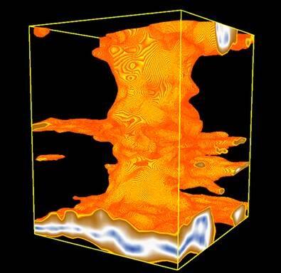
There are various imaging techniques in seismic geomorphology plus many other different seismic attributes and spectral decomposition techniques that are often able to enhance and bring out subtle features and/or lithologic changes that remain hidden within a traditional seismic amplitude display.

Figure 1: 3D Opacity Rendering of Karst Feature
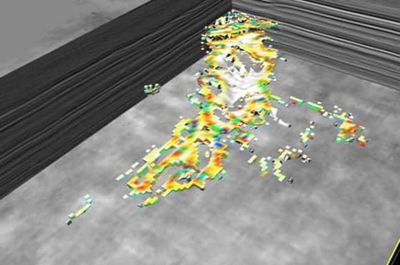
Flattening and various slicing techniques can be used to help unravel complexities related to non-uniform horizons. Volume co-rendering of differing attributes can provide additional insights as compared to a single attribute, and voxel body picking allows interpreters to focus on a specific range of attribute values which are useful in defining geobodies.

Figure 2: Voxel Body Sand Channel
Jim will take a deeper look at imaging techniques for seismic geomorphology on Monday, June 26 at the Annual Meeting of the American Association of Petroleum Geologists (Rocky Mountain Section) as part of the Bridging the Gap between Geology, Geophysics and Engineering session.
Jim Bock is a Senior Technical Advisor at IHS Markit.
Posted 7 June 2017
This article was published by S&P Global Commodity Insights and not by S&P Global Ratings, which is a separately managed division of S&P Global.
{"items" : [
{"name":"share","enabled":true,"desc":"<strong>Share</strong>","mobdesc":"Share","options":[ {"name":"facebook","url":"https://www.facebook.com/sharer.php?u=http%3a%2f%2fprod.azure.ihsmarkit.com%2fcommodityinsights%2fen%2fci%2fresearch-analysis%2fimaging-techniques-in-seismic-geomorphology.html","enabled":true},{"name":"twitter","url":"https://twitter.com/intent/tweet?url=http%3a%2f%2fprod.azure.ihsmarkit.com%2fcommodityinsights%2fen%2fci%2fresearch-analysis%2fimaging-techniques-in-seismic-geomorphology.html&text=Imaging+techniques+in+seismic+geomorphology","enabled":true},{"name":"linkedin","url":"https://www.linkedin.com/sharing/share-offsite/?url=http%3a%2f%2fprod.azure.ihsmarkit.com%2fcommodityinsights%2fen%2fci%2fresearch-analysis%2fimaging-techniques-in-seismic-geomorphology.html","enabled":true},{"name":"email","url":"?subject=Imaging techniques in seismic geomorphology&body=http%3a%2f%2fprod.azure.ihsmarkit.com%2fcommodityinsights%2fen%2fci%2fresearch-analysis%2fimaging-techniques-in-seismic-geomorphology.html","enabled":true},{"name":"whatsapp","url":"https://api.whatsapp.com/send?text=Imaging+techniques+in+seismic+geomorphology http%3a%2f%2fprod.azure.ihsmarkit.com%2fcommodityinsights%2fen%2fci%2fresearch-analysis%2fimaging-techniques-in-seismic-geomorphology.html","enabled":true}]}, {"name":"rtt","enabled":true,"mobdesc":"Top"}
]}

